Over half of Saint John's land mass (and two-thirds of the island if you include water) is US National Park. That makes it a trail runner or hiker's dream.
The book
Saint John: Feet, Fins and Four-Wheel Drive is an awesome guidebook.
http://www.amazon.com/John-Feet-Fins-Wheel-Drive/dp/0963106090
For maps, the Trail Bandit's is best when considering trails. You can find it at some shops on the island. There are different versions, but the maps on each are the same.
Ask for the Trail Bandit map. The NPS office sells one version, and I found another at a local dive/snorkel shop. There's no difference between the maps or trail descriptions that I can tell. You can download it for free at
http://www.trailbandit.org/. Big props to this guy for all he's done to discover, maintain, and map trails. He's got a fascinating history with the park.
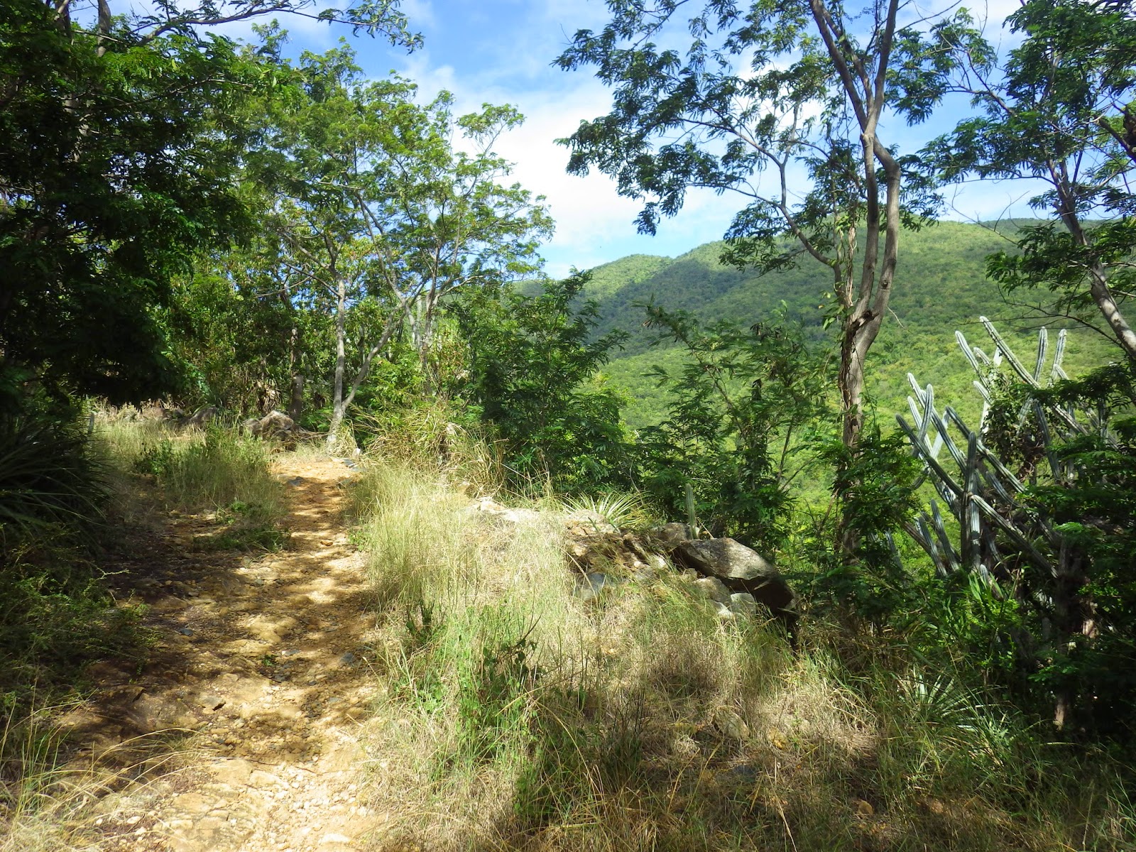
Most of my runs on Saint John were done on trails. These trails are often old ox roads from the sugar plantation days. On almost all of them I stumbled across ruins and many of those are marked on the Trail Bandit maps. My runs were 6-8 miles and I connected several trails together. After all, it's a small island. The roads are curvy and mountainous, not runner friendly, considering the traffic--and by the way, all driving is done on the left). I saw people running these roads and wondered, Why? There are amazing trails here. Maybe some people just prefer pavement. And I did sometimes run short portions of pavement to connect trails. We stayed on the south side, between Chocolate Hole and Hart Bay, and it was some road distance before I could find trails. In order to lessen impact of my running time on the rest of my family (we were sharing a rented Jeep), I dressed in my running clothes whenever we went to the beach and ran from there. The bonus to this was a wonderful swim at the end of each run.
Leinster Bay/Johny Horn Trail
I started this run at Maho Bay Beach and ran about a mile on roads to the Leinster Bay Trail. On the way I saw ruins of the Annaberg Country School and passed some cool mangrove trees.
 |
| Mangrove |
 |
| Rainbow from end of the road |
Near the Annaberg plantation ruins, the road ends and I followed a flat and scenic Leinster Bay Trail (an old road from the owner's house to the plantation) around the water's edge to Waterlemon Beach. We came back to this beach another day for snorkeling and it was our favorite snorkel spot with lots of fish, corals, and even a Spotted Eagle Ray. The Johny Horn Trail starts at this beach and passes several ruins right behind the beach, then goes up the mountain.
 |
| Pipe organ cactus on Johny Horn Trail |
 |
| Waterlemon Cay from Annaberg owner's house |
Eventually the trail becomes a gravel road and tops out. The view here was nothing spectacular, surrounded by trees, and a family with kids sitting around the trail. I turned around. On the way down, I took an unmarked spur trail and came out at what someone told me had been the Annaberg plantation owner's house. It was mostly foundation and steps and some walls, all overrun by lovely wildflowers. Back on the road, with Maho Bay Beach in sight, I took a fall, a real grinder that dug pebbles and pavement into my knee, back, shoulder and hands. Maybe this is why I like trails--I bounce better there. A car stopped to ask if I was okay, and when I asked if the fall looked good, they asked if I would do it again so they could see it better. I limped into a beach chair and washed off in the soothing salt water. So many lovely views on this run. There are parking lots at the end of the road/beginning of the Leinster Bay Trail so one could easily make this run all trail, and you could continue down the hill where I turned around, on toward the Moravian Church and Coral Bay.
Reef Bay Guided Hike
We made reservations for this one (and the Full Moon Guided Hike) through the Friends of the Park office. I didn't know if I would like hiking with so many other people, and it could get frustrating adapting to other people's pace, but there were plenty of advantages here. First, the guide, a volunteer named Kent, was amazing, and freely shared his wealth of knowledge about plants, animals, history, etc. The group met at the Park Service building in Cruz Bay, where two taxis took us to the hike's start on Centerline Road. Kent led us slowly down the hill to Reef Bay, through four different ecosystems, and on the way we visited different ruins, ancient petroglyphs, and an old sugar mill. We learned so much more than if we had done this hike on our own (in fact, we have done this hike on our own on a previous trip), and at Reef Bay, instead of turning around and hiking back to the top, we rode a dinghy out to a boat that took us around the island back to the Park Service building, a fun way to get a different view of the island.
 |
| Buttress root system (see, I was listening) |
 |
| Petroglyphs. Closest figure is a representation of a bat. Bats were important to the Taino, message carriers to their ancestors. |
 |
| Petroglyphs |
 |
| Sugar mill ruins |
 |
| Grave of W. H. Marsh |
 |
| Sugar mill ruins |
Bordeaux Mountain/Yawzi Point
This run starts at Salt Pond Bay, but it can be shortened by driving to the trailhead just beyond the end of the road, but be prepared to bounce around in your vehicle and get some mud on it, which is fun too. While my family settled in at Salt Pond Beach, I ran back to the parking lot, and to the end of the road.
 |
| Mom settling in at Salt Pond Beach while I play in the mountains beyond |
The road curves up and down some switchback hills, turns to gravel, turns to mud, and passes the Great and Little Lameshur beaches.
 |
| Road |
At some cool ruins overlooking the beach, there's a small parking area and both the Lameshur Bay and Bordeaux Mountain trails begin, as well as several spur trails.

The Bordeaux Mountain Trail starts as a Jeep road to the turnoff to the Ranger Residence. Then it steeply climbs along a ridge for over a mile.
 |
| Climbing |
The trail comes out on the Bordeaux Mountain Road. I followed this road to the right, but I now see if I would have gone left toward Centerline Road I would have hit the highest point on the island. I topped out near a house with views of Coral Bay, turned around, made friends with a dog protecting his driveway, and went back down the trail.
 |
| Turnaround |
 |
| Dog |
The way down offered many nice views of beaches and bays. I met a lady I had seen going the opposite way earlier. We both agreed it would have been a good idea to bring water along. She had been up much of the previous night drinking tequila.
At the bottom, I took the short Yawzi Point Trail to add a bit of mileage. It went through some huge pipe organ cactii to a point between Great and Little Lameshur Bays.
 |
| Pipe organ cactii |
 |
| Yawzi Point |
 |
| Yawzi Point |
The road back to Salt Pond got warm, but the swimming and snorkeling were, of course, wonderful. It's our favorite beach. Later, Lisa and I did the short walk from Salt Pond to Drunk Bay.
Drunk Bay
Apparently drunkin or something similar means drowned in Dutch and that's where the name comes from. Walking from Salt Pond Bay, turn left at the salt pond and follow its shore to Drunk Bay. Drunk Bay is full of coral people and animals, and we left one, just as we did last year.
 |
| Drunk Bay |
 |
| Drunk Bay mermaid |
 |
| Drunk Bay |
 |
| Drunk Bay dog or pony |
 |
| Drunk Bay cairn |
Catherineberg Road/L'Esperance
The rest of my family was hitting either Trunk Bay or Cinnamon Bay, depending on crowds and parking, so I asked Lisa to drop me off and pick me up at the bottom of the Catherineberg Road, which is between those two beaches. I asked her to pick me up in two hours and I started my watch. The Catherineberg Road isn't much of a road, and it's listed on the trails map, so traffic wasn't an issue. The road is dirt/gravel, but the switchback curves are paved. It climbs steeply at first and goes by some fancy gated homes. After 1.5 miles of steep climbing, I saw the ruins of a sugar mill, and shortly after, Centerline Road.
 |
| Sugar mill near Centerline Road |
|
I ran a short distance east on Centerline, less than a hundred yards, and found the L'Esperance Trail that goes down the south side of the island to the Reef Bay Sugar Mill. The L'Esperance Ruins are worth checking out, and there is a grave behind the house.
 |
| Louise Sommer, DOD 15 Sept 1864 |
 |
| L'Esperance |
The way down toward Reef Bay was lovely single-track trail, mostly mellow descent. I missed the spur to the Sieben ruins, which is where you can find the only Baobab tree on the island. I could hear the waves of Reef Bay when I decided to turn around. I had been running 1h 10m and had 50 minutes to make it back.
 |
| L'Esperance Trail |
The L'Esperance Trail connects to the Reef Bay Trail at Genti Bay, and one could easily make a big loop that hits both the north and south shores using the Cinnamon Bay and Catherineberg trails on the north side. This gives me one more reason to go back.
Ram Head Full Moon Guided Hike
This is another hike we arranged through the Friends of the Park. Our guide, Jennifer, is a landscape architect and her knowledge and passion for local botany is impressive. The hike to Ram Head isn't super long, about 3 miles round trip from the Salt Pond parking lot where the group met. We had been told to bring flashlights, but they really weren't necessary.
Ram Head is the southeast tip of the island, a place escaped slaves came to hide out and live. It was a lovely night with a bright moon and views of the south shore and many other island and I tried to imagine what this place felt like to those people, living by the light of the moon and stars, living in fear of being recaptured, holding tight to this momentary freedom.